35 application(s) found

Civil


    • CAD Utilities in surveyor and civil engineering field. It contains 73 modules which are useful to land surveyor or civil engineering. System requirement ZWCAD2020 ZWCAD2021 Pro, .Net Frameworks 4.5.1, Windows 7, 8, 8.1 and 10.

    • ProfLT is a program which offers functionalities for configuring, drawing and modifying longitudinal terrain profiles and cross sections.

    • CAD functions for civil constructions.Available for ZWCAD 2020 Pro or higher. 

    • Full solution for Surveying and Civil Engineering projectsProfessional version is designed to assist users in all the phases of carrying out a project for roads, developments, quarries, mines, etc.It includes all features of Standard version and also provides tools for the design of horizontal and vertical alignments, draw the project cross-sections, generate final ground, cut and fill reports, setting out…Optional modules are Surveying,  Point Cloud and Images.

    • FlashMNT - Digital Terrain Model Triangulation, contour lines, volumes.

    • MapBrowser is a software for visualization and query of cartographic data directly in the CAD environment, DWG compatible. It allows to access GIS data on Web by WMS, WFS, ArcIMS services.On these data it is possible to make queries, filters, zoom with the main aim to obtain, directly in the CAD graphic editor, georeferenced maps themed to suite your needs.

    • CivilCAD, created by ARQCOM, is designed to automate and simplify civil engineering and land surveying tasks within ZWCAD+ 2012. With over 20, 000 users since its introduction in 1996, CivilCAD is the standard for government agencies, construction companies and universities in Latin America. With CivilCAD, you can quickly create profiles, cross sections, contour lines, land subdivision, cut and fill volume calculations, and over 100 additional useful routines. You can complement this software with additional modules such as Water and Wastewater networks, Road Design, Mass Haul Data Export, Pluvial Wastewater networks and the new import/export data Interface for Google Earth™.

    • Survey and Cogo: Set points, traverse, sideshot, inverse, intersect, import & export points, import linework from point file, design lots by area. Label lines, curves and areas. DTM: Create a Triangulated Irregular Network. Use fault lines to control model. Create contours at user defined intervals. Calculate volumes. Unlimited number of surfaces. Create fully annotated profiles. Road: Cut profiles and cross sections from a digital terrain model. Create templates and proposed profiles. Calculate cross section volumes. Create fully annotated profiles and cross sections.

    • RD12 est un logiciel modulaire de topographie, allant du carnet au calcul de routes, disposant de nombreux assistants et d'un guide utilisateur avancé pour la personnalisation et l'ajout de commandes personnelles. Il est possible d'ajouter des fonctionnalités en téléchargeant des bibliothèques gratuites.

    • CadTools (ToolBox) is developed for Civil Engineers using ZWCAD+ 2014 and above

    • Application is dedicated for road engineers. It helps to design roads by support in: Inserting road signs (database of signs) Automation of drawing horizontal signs (lines, arrows, pedestrian crossing) Application contains module to designing own signs Creation reports from inserted elements Automation of drawing islands. Drawing trajectory of moving car

    • Topocal es un programa CAD independiente de Topografía y a la vez integrado con todas las versiones de AutoCad y ZWCad. Su principal función es la creación de modelos digitales del terreno y movimientos de tierras por perfiles transversales o por mallas, y cálculo de plataformas... con visión en 3D a todo color. Soporta la inserción de fotografías georeferenciadas, bloques, ficheros cartográficos ASC, DXF, KML, ASCII, PDF e infinidad de funciones de CAD. TopoCal es un programa potente, eficaz e intuitivo hecho por topógrafos para topógrafos

    • Topocal es un programa CAD independiente de Topografía e integrado con todas las versiones de AutoCad y ZWCad

    • This application enables the users to view and process point clouds created by LIDAR technology, scanners or photogrammetry software. It is possible to manage millions of points imported from files in common formats. Points can be viewed in natural color, intensity or category. The point cloud can also be viewed in stereoscopic mode with active or passive systems. MDT Point Cloud generates profiles and cross sections from a polyline or alignment as well as digital terrain model, and they can be exported to CAD. This optional module requires MDT Standard version or Professional version.

    • This software working in CAD environment process data gathered from total stations running TcpTunnel or other programs. TcpTunnel CAD computes the measured cross-sections from points and alignment, which can be filtered and edited, and lets you to compare with project template drawn as a polyline. It can draw cross-sections or 3-D tunnel mesh in individual mode or by sheets, with many customizable options. The software also computes under and overbreak areas and volumes, generating reports that can be sent to text, HTML, Word or Excel. TcpScancyr for Tunnels process tunnel data measured by a laser scanner.

    • Программный комплекс GEOCAD представляет собой, открытый набор совместимых программных продуктов, предназначенных для решения задач инженерных изысканий, геоинженерного проектирования и ГИС инженерного назначения.

    • Protopo es un programa de ingeniería civil, desarrollado por profesionales, ingenieros topógrafos y matemáticos, a través de la experiencia adquirida durante años de trabajo en campo, así como, recogiendo las opiniones y sugerencias que los usuarios nos han ido dando durante estos 25 años de vida de Protopo. Y, es por ello, que el programa sigue evolucionando, día a día, para conservar ese sitio que se ha ganado entre los profesionales de la topografía.

    • EPLANT-STH is a computer aided design system to generate 3D parametric models of  Structures, Cable Trays, HVAC and automatic MTO. Fully integrated in the ZWCAD environment the COPY, MOVE, DELETE and MIRROR commands can be used without any restriction. The material take off is automatic, as well as the weight and painting area calculation. Main use: to build structural components integrated with the EPLANT-Piping module.

    • DRAWING THE NETWORK AnkiSOFT Yazılım's wastewater (sewerage) network hydraulic design software, pissuCAD; is developped for wastewater network of infrastructure projects. It is for to draw/modelling/design/analyse the wastewater network under ZWCAD.

    • DRAWING THE NETWORK AnkiSOFT Yazılım's stormwater network hydraulic design software, yasuCAD; is developped for stormwater network of infrastructure projects. It is for to draw/modelling/design/analyse the stormwater network under ZWCAD.

    • DRAWING THE NETWORK AnkiSOFT Yazılım's water transmission line design software, isaleCAD; is developped for water transmission line of infrastructure projects. It is for to draw/modelling/design/analyse the water transmission line under ZWCAD.

    • DRAWING THE NETWORK AnkiSOFT Yazılım's water supply (drinking water) network hydraulic design software, isuCAD; is developped for water supply network of infrastructure projects. It is for to draw/modelling/design/analyse the water supply network under ZWCAD.

    • GA Przepustowość is software for junction performance analysis according to polish  instructions.

    • GA Sygnalizacja- traffic signal design software, enables engineers to produce traffic signal design drawings, measure and calculate traffic signal phase intergreens, prepare phase timing diagrams and prepare analysis of junction performance.

    • GA Znaki includes a comprehensive library of traffic signs, allows you to map out road markings and design traffic management. The software is offering a whole range tools and generators allowing user to create road signs according to polish standards for vertical, horizontal signs and traffic safety devices.

    • CivilCAD 2014 Solution Suite, the ultimate plan and design tools for civil engineering professionals, offers roads planning and design, upper and underground infrastructure design and pipes layout tools, intelligent and sensible earthworks calculations, and cross platforms surveying data handling capabilities.

    • Civil design suite software CECS software package is designed to support, with its program command groups, virtually all phases of civil design process. CECS 2.0 - Civil Engineering CAD Solution

    • With ARQ-Roof you will create and design any type of roofing in 3D starting with only one single polyline (the roof contour).

    • CAD Translate is a program which gives you the possibility of translating every text included in your CAD drawings into any language.

    • ESurvey KML converts your CAD data to KML and publishes it in Google Earth. Google Earth is a geo-browser which represents the Earth as a three-dimensional globe. Converting data available in Google earth in the form of KML File to 2 Dimensional CAD drawing and Vice Versa is possible with ‘ESurvey KML’. 
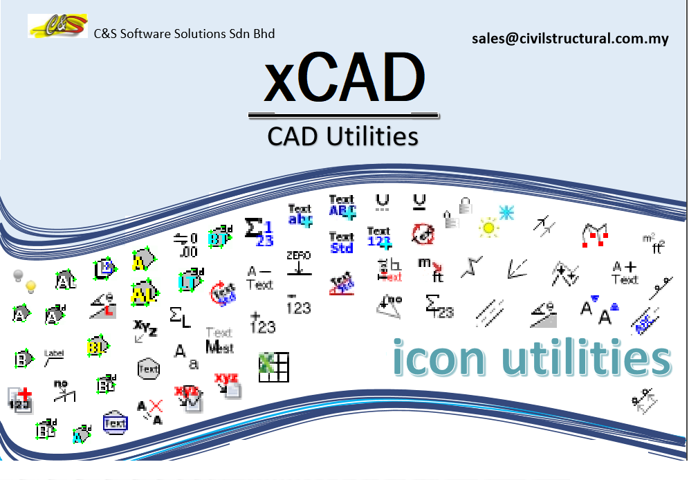
Features offered in ESurvey KML Export CAD Drawing to KML File (Point (Place Marker), Text, Line, Pline (Path), Polygon) Import KML File data as CAD Drawing (Point (Place Maker), Text, Line, Pline (Path), Polygon) Convert UTM Coordinate to Lat Long Convert Lat Long Coordinate to UTM Find Lat long of a Point with in your CAD Editor Benefit of choosing ESurvey KML Present your Drawing data on Google Earth and Impress your Customer Cross Check Survey Data with Google Earth Data to ensure accuracy Import Available Data from KML File and avoid retracing Publish (Export) your CAD Data to Google Earth KML File 2 Dimensional Drawings created in CAD (AutoCAD / BricsCAD / GstrarCAD / ZWCAD) including entities such as point, text, line, Poly line, polygon, etc. can be published (exported) to Google Earth in the form of KML File using ESurvey KML. Import Places information from Google Earth KML File into your CAD Package (AutoCAD / BricsCAD / GstrarCAD / ZWCAD) Data stored as place markers, Path or Polygon in Google Earth KML File can be imported to CAD Package using ESurvey KML. Convert UTM Coordinate to Latitude Longitude ESurvey KML allows you to convert UTM coordinate to respective Latitude Longitude. Single point conversion can be done with specific entry. UTM Converter converts given Easting Northing to Latitude / Longitude. This utility supports several map datum such as NAD83/WGS84, GRS 80, WGS72, Australian 1965, Krasovsky 1940, Clarke 1866, Bessel 1841 and Everest 1830. When there are more points to be converted, with Bulk option you can convert series of UTM Coordinates to Latitude Longitude at one shot via excel file using ESurvey KML. Convert Lat Long Coordinate to UTM ESurvey KML allows you to convert Latitude Longitude to respective UTM coordinate. Single point conversion can be done with specific entry. When there are more points to be converted, with Bulk option you can convert series of Latitude Longitude Coordinates to UTM at one shot via excel file using ESurvey KML. Find Lat long of a Point within your CAD Editor (AutoCAD / BricsCAD / GStrarCAD / ZWCAD) When the CAD Drawing is represented with Correct UTM Coordinates, using FLL Command of ESurvey KML we can find the Latitude longitude of any point in the drawing with Single Click. Before Running the Program we need to set the Map Datum (Ellipsoid), Hemisphere and Zone. After Setting the Datum, you can locate the Lat Long Point using ‘FLL’ Command

    •  E Survey Lisps ZWCAD/AutoCAD users have their own set of lisps for automation, which save a lot of time. But searching for a suitable lisp from this set of lisps is difficult. Also, most of these lisps are freely available on the Internet or custom made and hence are not properly documented. To address these issues, ‘E Survey Lisps’ has been developed. ‘E Survey Lisps’ is a collection of tailor-made lisp routines developed exclusively for AutoCAD users working on Survey drawings.   Features: Access all Survey related macros from single elegantly defined menu Macros classified into 13 categories ranging from text to interpolation   Benefits: Saves considerable time while working with Survey Drawings. Increase the output drawing quality and productivity to a great extent.

    •  LAND SURVEY CONCRETE STRUCTURES DESIGN DEVELOPING APPLICATION IN AUTOCAD FOR SURVEYOURS AND CIVIL ENG.

    •  LAND SURVEY CONCRETE STRUCTURES DESIGN DEVELOPING APPLICATION IN AUTOCAD FOR SURVEYOURS AND CIVIL ENG.
PLEASE NOTE: These applications are created by third party providers. Downloading, installation, licensing and support are under the publisher's responsibility only.

© 2021 ZWSOFT CO., LTD.(Guangzhou) All rights reserved. Privacy Policy.

All other trademarks cited herein are the property of their respective owners.