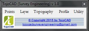
TojoCAD offer powerful software solutions to Surveyors and Civil Engineers and dedicated to serve most powerful products to develop better, more presentable drawings and accurate reports. TojoCAD is economically priced; easy to use; and capable of addressing most of civil engineering and surveyors requirements.
TojoCAD is designed for considering the fact that surveyors and engineers with basic CAD software knowledge can generate required outputs without getting in to lengthy training, big manuals, memorizing operation sequences or navigating through multiple windows. TojoCAD aim’s at improving the work force efficiency, by saving time and increasing productivity.
Easy to import field survey data in CSV and TXT file format with their identified layers name and plot label text with specify text height and rotation angle.
Export CAD data (Point, Line/Polyline and 3D Poly) with XYZ and layer name in CSV and TXT file in single click.
CoGo function to interpolate point in different method.
Interpolate no of points between two points in equal interval.
In a single click convert points to specified block and also convert block to points in a second.
Draw line automatically between selected points.
Indentify distorted points in thousand of points and user specify modification options for modify those points.
Multiply options available for point labeling.
Layer management like Freeze, Thaw, On, Off, Lock, Unlock etc. in a single click.
Point triangulation, generate contour in specify interval, contour labeling, user define contour coloring and spot label just in a click.
Generate regular interval DTM with user specify interval.
Draw longitudinal section with user specify profile line and custom options.
Draw quick profile with user define options.
Draw map grid in a single click.
Insert hundreds of north arrow symbol from north arrow library.

Import field data

Draw field data in CAD

Generate Contour

Generate DTM

Draw Profile
Company:
Website:
Contact person:
Phone:
Email:


